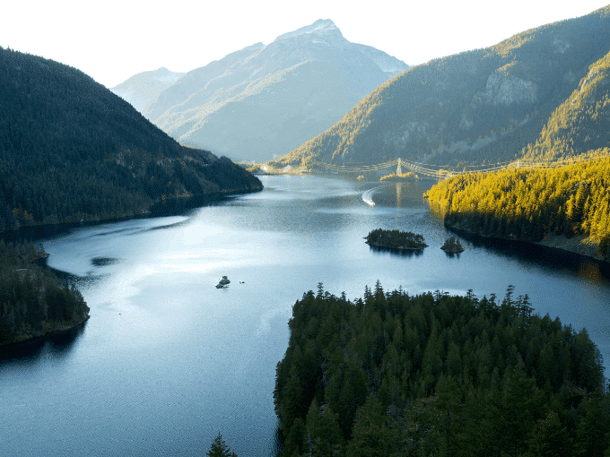
Your Best Day Hikes in Mt Rainier National Park
If you’ve ever been to Seattle, you know that the summit of Mt. Rainier is a beacon, calling you to explore its wilds—less than 60 miles away from the bustling city center. With over 28 major glaciers and reaching 14,410-feet at its highest point, the active volcano is well-known as a mountaineering destination.
But if, like me, you’re more of a trekking-poles-over-ice-axe kind of adventurer, you, too, will find many trails to fall in love with in the 236,380-acre national park.
In this article, I’ll share three of my favorite hikes in Mt. Rainier National Park. These trails aren’t the ones that you’re going to find on every list out there, which means you’re less likely to be fighting the hordes during peak season.
Moreover, you will still be awed by stunning glacial views, enchanted by viridescent forests, and serenaded by rushing waterfalls.
Getting To and Around Mt. Rainier National Park
Mt. Rainier is best explored with a car as there are limited public transportation options. It’s divided into five main areas, which aren’t that close to each other. So, depending on the duration of your trip, you might stay focused in one zone, or you might want to explore them all to experience the variety of environments.
Before heading to Mt. Rainier, be sure to check the National Park Service site for any road closures or other alerts that may affect your travel plans.
The Zones of Mt. Rainier National Park
This magnificent park radiates the natural beauty of the Pacific Northwest, offering rivers, wildflowers, forests, and mountain peaks. Day hikers can choose a particular zone within the park to find the best place for their outdoor adventure.
Here are the five zones within Mount Rainier:
Related Reading: Best Day Hike in Banff for Panoramic Views
How to Purchase a Pass for Mt. Rainier
To enter Mt. Rainier National Park, you’ll need either an annual interagency Parks Pass (great motivation to see many of our country’s beautiful parks), or a yearly or weekly pass for Mt. Rainier National Park.
You can purchase the passes online in advance or during daylight hours at the entrance gate. The yearly pass, as the name suggests, is good for entry during the entire calendar year, while the weekly pass is valid for entry on seven consecutive days. The passes are per vehicle, rather than per person.
Three Superb Day Hikes in Mt. Rainier National Park
Here are my top three picks for the best hikes in Mount Rainier National Park.
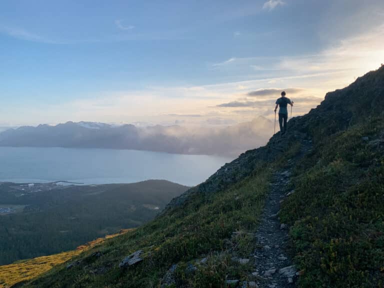
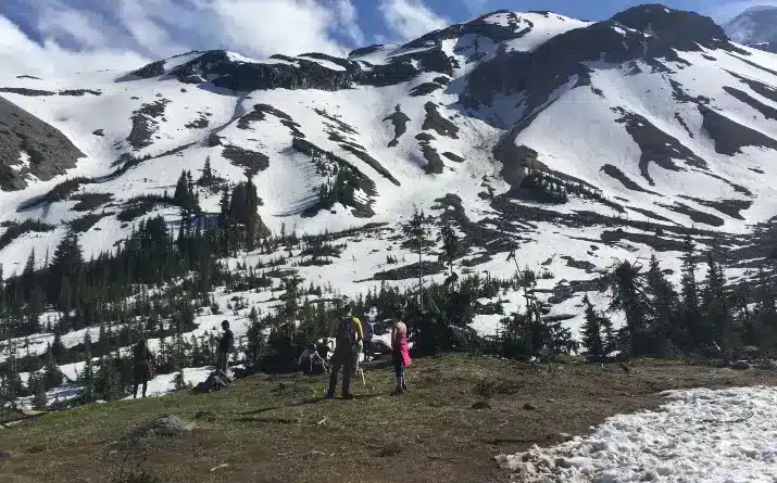
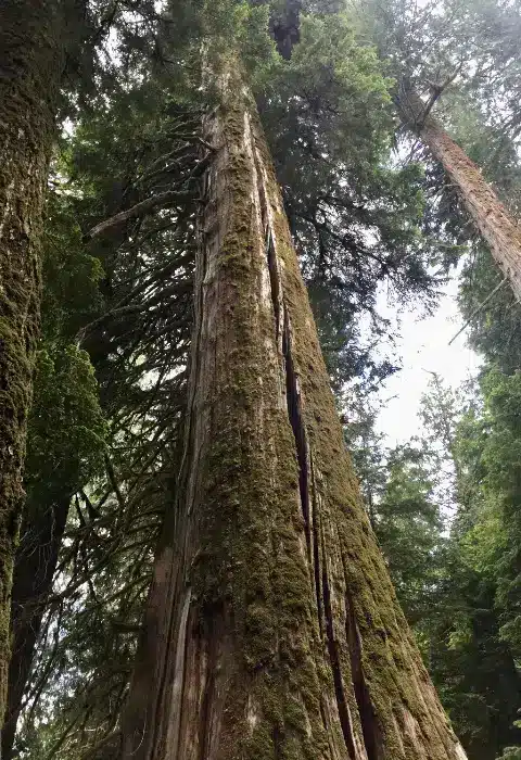
Glacier Basin
Overview of Glacier Basin Hike
Glacier Basin Hike
This trail offers a moderately strenuous hike that rewards you with striking views of Mt. Rainier’s glaciers. It’s one of those shh-let’s-keep-it-a-secret hikes. It doesn’t get the same foot traffic as the Mount Fremont Lookout, for example, but possesses that perfect forest-to-views ratio.
Following an old mining road—abandoned because the copper payload wasn’t big enough—the route begins at the White River Campground and then begins climbing alongside the Inter Fork of the White River. I’m a huge fan of trails that give you a warm-up section before dropping you onto steady climb, and this trail does just that. You begin with a gradual ascent through the forest that gets steeper over time.
In the middle of June, the trail bursts with green foliage, welcoming those strong solstice rays. And just as you’re getting tired of climbing, it opens up to drop you in a wide meadow. On a clear day you’ll have views of Inter Glacier, Winthrop Glacier, and Emmons Glacier, possibly strewn with some telemark skiers making their way across the snowfields.
Detour to Emmons Moraine Trail
It’s an out and back trail. So, once you’ve found a great spot to have your snacks and soak in the beautiful views, you will descend the way you came.
If you’re feeling energetic, you can take a one-mile round trip detour to the Emmons Moraine Trail. The extended route is a great place to get a closer view of Emmons Glacier, the largest glacier in the contiguous U.S.
Related Reading: How to Pack Your Daypack Like an Outdoor Pro
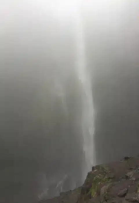
Comet Falls to Mildred Point
Overview of Comet Falls Hike
If you’re ready for a climb, the trail to Comet Falls and Mildred Point will get your heart pumping and reward you by getting you up close and personal with a 300-foot waterfall and views of the Kautz Glacier.
Ascent From the Start
Right from the get-go, you’ll be ascending. After climbing for about a quarter mile, you’ll come to a wooden bridge that crosses over Van Trump Creek, where you can look down at Christine Falls from above (for a better view of that falls, however, head to the Christine Falls pullout along Paradise Road before or after your hike).
Cross the bridge and you’ll follow Van Trump Creek up through its canyon. Switchbacks will bring you up through the forest until you emerge at the base of a waterfall. If it’s not quite the thunderous rush of water that you were expecting, that’s because it’s not Comet Falls, but Boucher Falls, a smaller but still lovely waterfall along the route.
Reach Your Reward: Comet Falls
Continue on for another 200 feet and voila! Comet Falls will present itself in all its misty glory. Dropping 300 feet, the Falls is a powerful force to behold. You could turn around here for a short hike (3.6 miles roundtrip), but since you’ve made an effort to climb this far, I recommend you continue along the hiking trails to see the views from Van Trump Park and Mildred Point before descending.
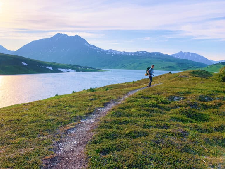
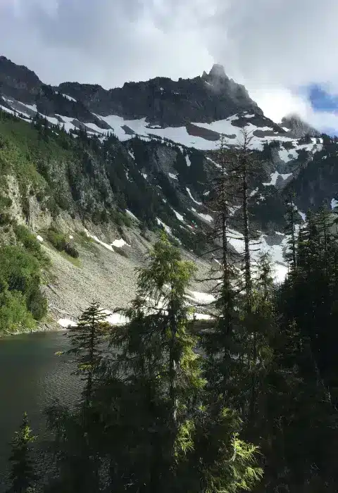
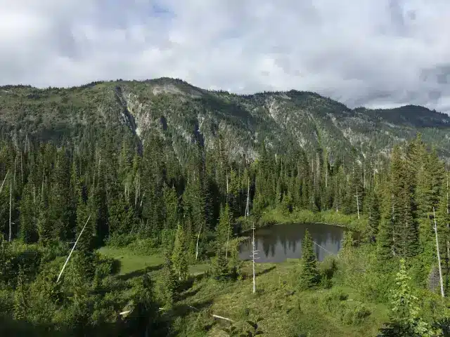
Bench and Snow Lakes Trail
Overview of Snow Lakes Trail
This easy-to-access trail on the southern side of the park meanders past two lakes, Bench and Snow. Since it’s relatively short, it’s a great warmup hike before a longer route or for when you want a more mellow excursion.
This easy trail begins with a decline as you head towards Bench Lake, where after three-quarters of a mile, you can take a spur trail to head to its shores. Beware that in some seasons, the shore has an active hornet’s nest and is best avoided.
Best Views of Mount Rainier
Back along the main route, the trail undulates as it delivers you to Snow Lake. Here is where you’ll discover some of the best views of Mount Rainier with its majestic ridges and glaciers. If you’re feeling brave, you can take a dip in its cold waters.
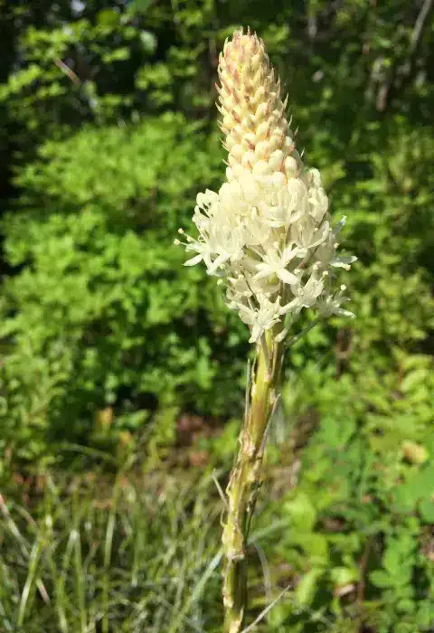
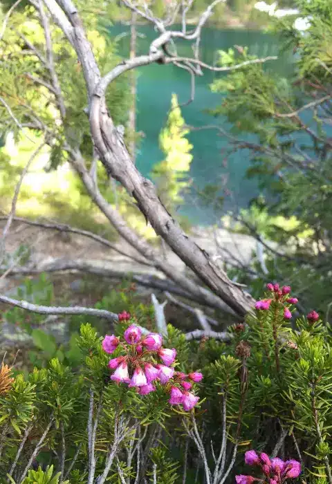
Flora
One of the reasons I love this trail is that since it’s relatively low-key and I’m not huffing and puffing, I can really take in the panoramic views and surrounding flora as I walk the trail. I especially liked catching glimpses of beargrass, a member of the lily family, whose leaves have been used by Native Americans for basket weaving and by grizzly bears to line their winter dens.
Plan Your Day Hike to Mt. Rainier
Mt. Rainier National Park has options that will suit every level of adventurer seeking time in nature. I hope that the next time you’re lucky enough to be at the park housing the lower 48’s most glaciated peak, you’ll find as much joy in these hikes as I did!
Related Reading
Extra Tips for Visiting Mt. Rainier
Here are a few key things to know to help you plan a day trip to Mt Rainier.
Popular Mt Rainier Hiking Trails
If you can extend your stay in the area and would like to experience more of the natural beauty this park has to offer, here are three of the more well known hikes to consider.

Jane Cullina is based in Santa Barbara, California, where she draws inspiration from the juxtaposition of sea and mountains that frame her surroundings. Her experiences as an outdoor educator on both coasts cemented Jane’s belief that time spent in nature leads to extraordinary moments of growth and connection. Today, whether at work as a project manager, educator, and writer, or at play in the wilderness of the U.S., Canada, and beyond, Jane seeks to weave together the practical with the profound.